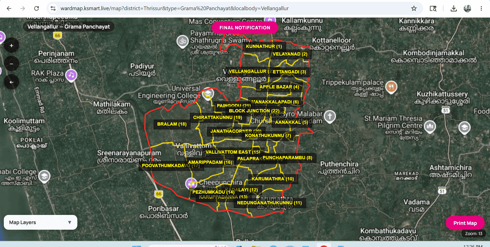
Vellangallur Grama Panchayat Geography-Map

Vellangallur Grama Panchayat
Geographical Features
📍 Thrissur District
1. Boundaries
The boundaries of Vellangallur Panchayat are shared with surrounding major areas:
- North: Velookkara Grama Panchayat
- South: Parts adjacent to Kodungallur Municipality
- East: Vadakkummuri Village, Puthenchira Panchayat
- West: Sreenarayanapuram, Poomangalam Panchayat, Canoli Canal
2. Topography & Terrain
Geographically, Vellangallur Panchayat is primarily included in the Midland region.
- The soil consists of plains, small hillocks, and valleys.
- Fertile Alluvial soil and Laterite soil are found across many parts, making it highly suitable for cultivation.
- Sandy soil with coastal characteristics can also be seen near the western borders.
3. Water Bodies & Wetlands
The most notable water sources in Vellangallur's geography include:
- Canoli Canal: Flowing along the western border, playing a major historical role in water transport and agriculture.
- Cole Lands: Large wetlands and paddy fields that help store water during the monsoon and maintain groundwater levels.
- Numerous streams and ponds also assist in smooth irrigation across the area.
4. Climate
Vellangallur experiences Kerala's general Tropical Climate.
- Rainfall: Receives abundant rainfall from both the Southwest and Northeast monsoons.
- Temperature: Temperatures are higher during March to May (approx. 32°C - 35°C), while June to October brings a cooler environment with heavy rains.
5. Agriculture & Land Use
The majority of the land is utilized for farming. Main crops include:
- Wetlands & Paddies: Paddy cultivation is the primary wet-land farming activity.
- Highlands/Islands: Coconut, arecanut, nutmeg, banana, vegetables, and tuber crops are widely cultivated. The soil is particularly suitable for nutmeg production.
6. Connectivity & Transport
Geographically, major transport routes connecting Thrissur and Ernakulam districts pass through here:
- State Highway 51 (Thrissur - Kodungallur Road) passes through Vellangallur Junction, seamlessly connecting the panchayat to major commercial hubs like Kodungallur, Irinjalakuda, and Thrissur.
In short, Vellangallur is a beautiful Central Kerala village rich in canals and cole fields, with a geography highly suitable for agriculture.
📍 Vellangallur Panchayat Map (Google Maps)
Click the button below to view the exact location of Vellangallur Grama Panchayat on Google Maps: